One platform for planning and development work: all the planning data you need, with AI that handles everything from researching sites to drafting documents and managing projects.
Planther checks a site against every constraint and designation, and sets out the local plan position, housing land supply and planning history behind it, each with its source.
Over 60 checks, run in seconds
Flood, heritage, ecology, green belt, trees and more
The council's land supply and delivery test, read for you
Planther
New chatToolsMap
New project
Land west of Wootton6
Site reportPlanning statementPre-app questions
Mill Lane, Little Shelford4
Station Road appeal3
Barn conversion, Elm Farm2
SatelliteMap
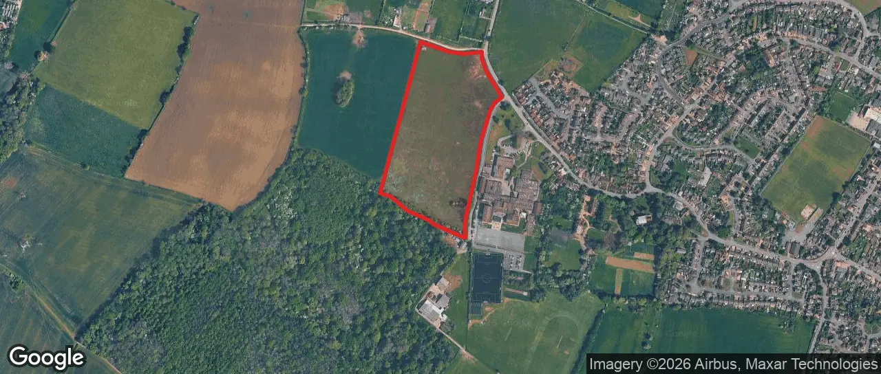
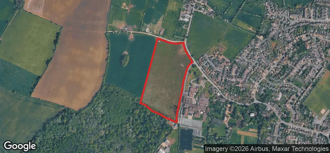
Land west of Wootton, Bedford
Bedford Borough Council · 6.5 ha
Actions
Natural environment
Flooding
Flood risk
Flood zone 1. Nearest flood zone 2 is 1.7km away.
Verify
Landscape
Green belts
Not within a green belt. Nearest is Central Bedfordshire, 7.3km away.
Verify
National landscapes (formerly AONBs)
Not in a national landscape. Nearest is the Chilterns, 15km away.
Verify
Trees
Ancient woodlands
Wootton Wood ancient woodland is 160m from the site.
Verify
Nearest ancient woodland: 160m from the site boundary.
Status
Name
Area
Distance
PAWS
WOOTTON WOOD
37.6 ha
160 m
Ecology
SSSIs
Not within an SSSI. Nearest is Marston Thrift, 4km away.
Verify
Land type and quality
Agricultural land
Grade 3a - best and most versatile agricultural land.
Verify
Heritage
Conservation area
Not in a conservation area. Nearest is Wootton, 280m from the site.
Verify
Listed buildings
No listed buildings within 250m. Nearest is Grade II*, 359m away.
Verify
Scheduled monuments
No scheduled monuments within 250m.
Verify
Planning policy and guidance
Local plan designations and allocations
Wootton Wood County Wildlife Site, Forest of Marston Vale, green infrastructure opportunity zone.
Verify
Article 4 directions
Bedford does not publish its article 4 directions - check the council's own page.
Verify
Material considerations
Housing land supply: 3.35 years
Below the 5-year requirement - base date 1/4/2025
Verify
Housing Delivery Test (2025): 94%
Consequence: action plan
Verify
Planning history
Planning applications
On the site: outline for up to 81 homes, refused 2019. 46 more within 250m.
Verify
47 applications within 250m of the site boundary. One is on the site: an outline for up to 81 homes, refused in 2019.
On the subject site
Ref
Description
Status
Date
19/00894/MAO
Outline application with all matters reserved except access for the erection of up to 81 dwellings.
Refused
25 Nov 2019
Nearby
Ref
Description
Status
Date
25/01577/AOC
25/00391/FUL - Condition 3 - BNG (Discharge of Condition)
Granted
1 Sept 2025
22/00522/MAF
New artificial pitch with fencing, floodlights, acoustic fence, erection of a pavilion with changing rooms, new car park
Granted
26 Sept 2022
20/02534/FUL
Brick plinth, rendering of property and re-tiling of roof and porch
Granted
21 Dec 2020
Draft entire planning documents
Planther researches every part of the site and project, then drafts the whole document in your style, from planning statements and appraisals to design and access statements.
Every reference cited, so each point can be checked
Maps you can move and adjust before you export
Exported to Word, ready to finish and send
Planther
New chatToolsMap
New project
Land west of Wootton6
Planning statementSite reportAppeals
Mill Lane, Little Shelford4
Station Road appeal3
Barn conversion, Elm Farm2
Land west of WoottonPlanning statementShare
Draft the planning statement. Lead on the land supply shortfall and use the Wilstead and Roxton appeals.
Find the policies that apply
Read the Wilstead and Roxton appeals
Agree the sections
Add the site plan
Write the statement
The planning statement is drafted, with each policy and appeal cited where it is used and the site plan as Figure 1.
Planning Statement - Land west of WoottonExport
Files for this project / Planning Statement - Land west of Wootton.md
Planning Statement - Land west of Wootton
1. Introduction
1.1 This statement supports an outline application for up to 120 homes, public open space and a new access on 6.5 hectares of land west of Wootton. The site lies outside the settlement policy area Bedford LP 2030.
Figure 1: Site location
2. Housing land supply
2.1 The council accepts that it can show only 3.35 years of housing land supply. In the Wilstead appeal the inspector called this "a significant shortfall against the five-year requirement" Appeal 3376539, so the presumption in favour of sustainable development applies NPPF.
2.2 The Bedford Local Plan 2040 was withdrawn from examination on 8 October 2025, so no emerging plan is close to restoring a five-year supply.
Find the appeals that matter
Ask for the appeals you need in plain English. Planther reads every decision letter that might matter and brings back the ones that help, with the inspector's own words and the paragraph they come from.
About 198,000 appeal decisions to search
Every likely letter read, up to 1,000 in one search
Land west of WoottonAppeals for the statementShare
Find allowed appeals in Bedford since 2024 for ten or more homes outside a settlement, where the council could not show five years of supply.
Search Bedford appeals since 2024
Read each letter for the supply finding
Pick the strongest three
Nine appeals match, and I read every letter. The three strongest for you are in the panel, each with the inspector's own words.
In all three the inspector found the most important policies out of date, and gave the benefits of new homes the greater weight.
Appeals for the statementListMapSave searchCopyExport
9 of the 877 appeals in Bedford match.
BedfordAllowed10 or more homesSince 2024No five-year supply
Chosen by Planther · 9 of the 9 letters read
Allowed·Hearing·26 May 20261 of 9
Land on the east of Duck End Lane, Wilstead
Bedford Borough Council3376539·Major dwellings, 149 homes
Why it matches
Homes outside the settlement boundary allowed because Bedford could not show five years of supply.
What the inspector said
“The Council concedes that it is currently only able to demonstrate 3.35 years of housing land supply” (para 52)
Allowed·Hearing·24 Jul 20262 of 9
Land north of Hall End Road, Wootton
Bedford Borough Council6004689·Major dwellings, 90 homes
Why it matches
Allowed on the edge of Wootton despite harm to character, because the tilted balance applied.
What the inspector said
“The most important development plan policies cited above are however deemed to be out-of-date.” (para 74)
Allowed·Hearing·2 Jul 20253 of 9
Land at Bedford Road and High Street, Roxton
Bedford Borough Council3357192·Major dwellings, 50 homes
Why it matches
Conflict with the plan's distribution of growth outweighed by the supply shortfall.
What the inspector said
“the presumption in favour of sustainable development set out in paragraph 11 d) of the Framework applies” (para 109)
Every council's plan position, in one place
See where a council's local plan stands, which plans are in force and which have fallen away, alongside its housing land supply, delivery test results and its planning documents.
Adopted, emerging and withdrawn plans, with their dates
Land supply as the council states it and as inspectors have found it
Local plans, neighbourhood plans and guidance to search
Planther
New chatToolsMap
New project
Land west of Wootton6
Mill Lane, Little Shelford4
Station Road appeal3
Barn conversion, Elm Farm2
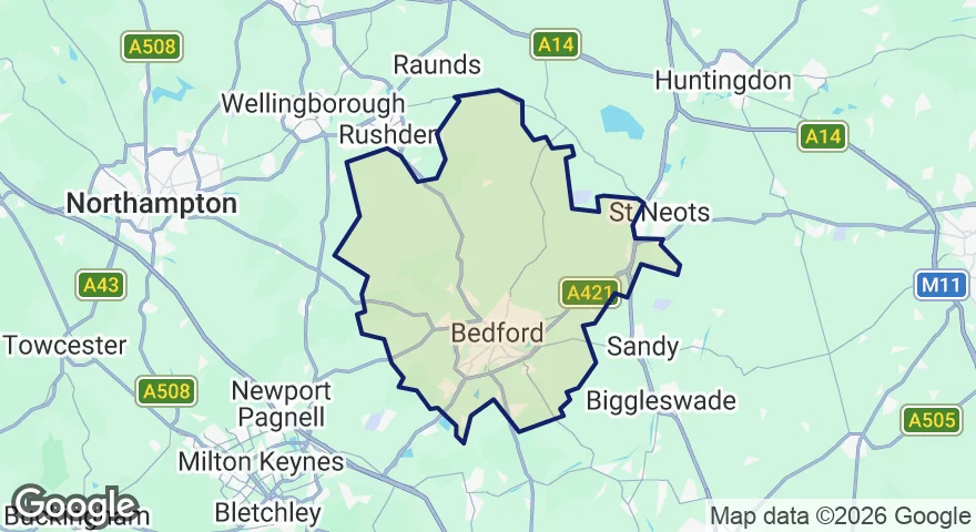
LPA:Bedford
Bedford
Planning policybedford.gov.uk
Council websitebedford.gov.uk
Open in mapView the boundary on the map
Five-year housing land supply
Verify
Council's stated position
3.35years
Base date 1 April 2025
Estimated position from appeal decisions
At appeal in May 2026 the council conceded 3.35 years, a significant shortfall.
Read the decision letter
Housing Delivery Test
Verify
94%
Action plan
2025 measurement · 2,812 of 2,981 homes delivered over three years.
2022-23
1,496 / 970
2023-24
727 / 970
2024-25
590 / 1,041
Local plans
The Local Plan 2030 is in force. The Local Plan 2040 was withdrawn from examination on 8 October 2025, so a new plan will be prepared under the new plan-making system.
In force now
Bedford Borough Local Plan 2030
Adopted 15 January 2020
Adopted
Allocations and Designations Local Plan
Adopted 17 July 2013
Adopted
Past plans
Bedford Local Plan 2040
Withdrawn from examination, 8 October 2025
Withdrawn
Bedford Borough Local Plan 2002
Some policies saved
Saved policies
Key documents
Search documents...
Local Plan 2030
Allocations and Designations Local Plan
Wootton Neighbourhood Plan
Bromham Neighbourhood Plan
Great Barford Neighbourhood Plan
Sharnbrook Neighbourhood Plan
Every project, kept on track
Planther keeps a tracker for each project: the documents it needs, who is preparing them, when they are due and where each one stands. It keeps itself up to date from the project's files and chats, so the whole team sees the same picture.
Documents, people and firms for every project
Kept up to date by Planther as the work comes in
Ask it what is outstanding, and who is on it
Planther
New chatToolsMap
New project
Land west of Wootton6
Project ManagerPlanning statementSite report
Mill Lane, Little Shelford4
Station Road appeal3
Barn conversion, Elm Farm2
Land west of WoottonProject ManagerShare
What is still outstanding before we can submit?
Five of the twelve documents are still to come in. The two that need chasing:
Transport assessment - due 21 Nov, still in progress.
Arboricultural impact assessment - nobody is on it yet. With Wootton Wood ancient woodland 160m away, I have added it to the tracker.
Documents12People9Firms7Updates23
Caught up - 4 changes.See what changed
Ready for validation · 7 of 12 in7 in4 under way1 not started1 with nobody on it
Document
Who
Status
Due
Version
Validation
Planning statement
CSClaire ShawUs
Draft received
14 Nov
v2
Local list
Transport assessment
DMDan MorganRidgeway Transport
In progress
21 Nov
Local list
Flood risk assessment
PLPriya LalFenland Water
Final received
3 Nov
v3
National list
Ecological impact assessment
THTom HartHart Ecology
In progress
28 Nov
Local list
Arboricultural impact assessment
Nobody yet
Not started
5 Dec
Local list
Landscape and visual appraisal
RBRuth BellOuse Landscape
Draft received
18 Nov
v1
Local list
Agricultural land classification
SKSam KingFieldwise Soils
Final received
30 Oct
v1
Local list
Design and access statement
JAJo AhmedNorthgate Architects
In progress
2 Dec
National list
The whole planning picture on one map
See every constraint, designation and planning application laid out on one map. Click anywhere to see what applies there, and ask Planther about what is on screen.
Constraints, designations, policy areas and planning history
Everything at a point in one click
A site report or an appraisal from any spot on the map
Planther
New chatToolsMap
Search layers...
Your projects
Project sites
Planning policy designations
Local plans
Green Belt
Article 4 directions
Natural environment
Flood zones
Surface water flooding
Tree Preservation Orders
SSSIs
Built/planned environment
Conservation areas
Listed buildings
Scheduled monuments
Transport
Public rights of way
Planning history
Planning applications
Planning appeals
Search a place, postcode or address
Wiltshire
At this point
Flood zone
Zone 1
Green Belt
Touches the edge
Conservation area
Touches the edge
Listed buildings
Grade II, 135m
Ask Planther about this locationSite reportAppraisal
Ask Planther
Planther inside Claude, ChatGPT and Copilot
Connect Planther to the AI tools you already use, and they can check sites, search appeals and look up policy with Planther's data. It comes with every plan.
We will show you round Planther, then set you up with a trial so you can try it on your own work. We can usually have you, or your whole firm, up and running the same day.
Bringing a whole firm? We can work to your own contract and data processing agreement, and invoice you directly.